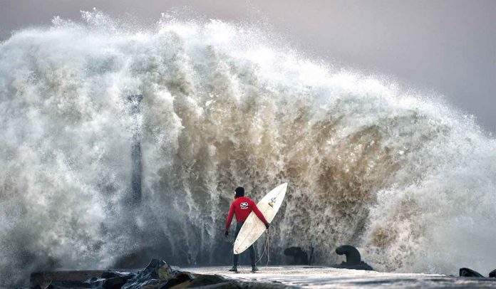
The Met Office has issued yellow weather warnings for parts of the UK for toay and the next few days as Storm Gareth brings powerful winds and heavy rain. The weather warnings on Tuesday and Wednesday cover much of England, Wales, Northern Ireland and parts of Scotland. A tweet said: “Storm Gareth will bring strong winds across Northern Ireland through Tuesday afternoon into Wednesday, bringing the risk of damage to buildings, flying debris, large waves, power cuts and travel disruption.”
10.04pm update: Flood warnings for Scotland
The Scottish Environment Protection Agency (SEPA) has issued nine flood alerts on Tuesday night.
These cover Ayrshire and Arran, Tayside, Argyll and Bute, Dumfries and Galloway, the Borders, Skye and Lochaber, the Western Isles and western and central regions.
Warnings were also issued for Ayr and Troon and areas around the River Earn.
Flood warnings are put in place to show a serious risk of flooding.
9.25pm update: Met Office warn commuters to be careful
The Met Office has tweeted warning those travelling tomorrow morning to stay weather aware during Storm Gareth.
The tweet read: “#StormGareth will continue to bring severe gales and heavy showers for Wednesday morning’s rush hour. Take heed of the warnings and stay #weatheraware”
8.42pm update: Stunning NASA images show Storm Gareth from space
Images shared by the Met Office and released by NASA show Storm Gareth swirling across the UK from space.
Heavy clouds across much of the country can be seen, alongside the circling mass of the storm.
8.05pm update: Weather forecast for this evening and tomorrow according to the Met Office
This Evening and Tonight:
Very windy, with severe gales in the north. Heavy and squally showers across northern and central parts with risk of hail of thunder. Drier in the south with clear spells and a few blustery showers.
Wednesday:
Cold and very windy with sunshine and showers, heavy in places with snow over northern hills. Showers will steadily ease but rain will reach the west later.
7.20pm update: Recap on tomorrow’s weather warnings
Areas affected by Wednesday’s weather warnings are: Central Tayside and Fife, East Midlands, East of England, Highlands and Eilean Siar, London and South East England, North East England, North West England, SW Scotland, Lothian Borders, South West England, Strathclyde, Wales, West Midlands, Yorkshire and Humber.
For these areas the Met Office warn to expect: Strong west to northwesterly winds are expected from Tuesday afternoon until Wednesday with possible transport disruption.
Delays for high-sided vehicles on exposed routes and bridges likely, some short term loss of power and other services is possible and it’s likely that some coastal routes, sea fronts and coastal communities are affected by spray and/or large waves.
6.46pm update: Met Office rain radar latest update
The Met Office has tweeted their latest rain radar update.
The weather service said: “The latest #radar shows rain clearing southeastern areas but a rash of showers are affecting the north and west #StormGareth #weatheraware.”
6.04pm update: Could Storm Gareth cancel Ladies Day at Cheltenham Festival?
It is too early to say whether or not Cheltenham Festival will be cancelled for day two, but event organisers are keeping a keen eye on the weather forecast.
Clerk of the course, Simon Claisse’s, latest forecast suggests gales of up to 50mph might see the racing day cancelled.
He said in an update on Twitter: “We wanted to give you an early insight into conditions for tomorrow as the forecast is looking challenging with strong gusting winds throughout the day.
“We are continually monitoring the situation and will keep racegoers informed as the conditions present themselves.”


